


Zevtt - St Cyr

kipoura
User
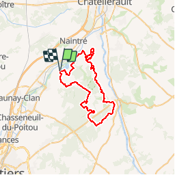

Length
51 km

Max alt
143 m

Uphill gradient
806 m
Km-Effort
61 km

Min alt
55 m

Downhill gradient
806 m
Boucle
Yes
Creation date :
2019-05-03 17:10:53.687
Updated on :
2019-05-03 17:10:53.782
3h30
Difficulty : Medium

FREE GPS app for hiking
 SityTrail
IGN / Geographical institutes
SityTrail Plus
The world is yours!
About
Trail Mountain bike of 51 km to be discovered at New Aquitaine, Vienne, Beaumont Saint-Cyr. This trail is proposed by kipoura.
Description
Une boucle VTT au départ du plan d'eau de St Cyr, si je ne m'abuse on commence par une grimpette bien harde .... http://zevtt.free.fr
Positioning
Country:
France
Region :
New Aquitaine
Department/Province :
Vienne
Municipality :
Beaumont Saint-Cyr
Location:
Saint-Cyr
Start:(Dec)
Start:(UTM)
305644 ; 5177411 (31T) N.
Comments